

By: Fabakary B. Ceesay
During the course of our investigation into the Busumbala Jatta Kunda clan and Jobe kunda of Serrekunda, land dispute, the Trumpet newspaper has discovered that at least two different maps showing the thirty percent of Jobe kunda family located at Jabang and Tawto-Daru within Busumbala farmlands. The said maps were drawn by different land surveyors.
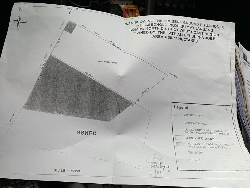
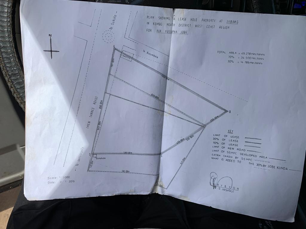
One by current principal land surveyor Mr. Modou Joof and the other by Mr. Ousmn S. Jarjusey an independent land surveyor one time land officer of the department of lands.
The map drawn and signed by Modou Joof principal Land Surveyor Department of Lands on 3rd January 2018, whiles the second one was signed by Ousman S. Jarjusey a private independent land surveyor on 16th July 2019.
All the maps show different dimensions of the same land. The warring parties have been fighting over the boundaries of the said lease land for three years leading to destruction of properties.
Mr. Modou Joof drew the map on his capacity as the Principal Land Surveyor which was not accepted by Jatta Kunda, whiles Mr. Jarjusey was contracted by the Police investigation team, after clashes occurred between warring parties. Jarjusey’s report and recommendations were also rejected by Jobens.
Mr. Jarjusey was a veteran land official and was involved in the process of the leased agreement of the said land in dispute. The said leased was done on 3rd July and approved on 23rd September 1998.
At the time Jarjusey was a senior official of the lands department. He signed the lease agreement between Jatta Kunda and Jobe Kunda.
In a chat with Permanent Secretary Buba Sanyang and Deputy Permanent Secretary Technical, Mr. Musa Badjie, of the Ministry of Local Governments and Lands, both assured that the matter will be sort out soon based on the plans and measures they intended to use.
PS Sanyang call for calm and patience as they have many such issues at hand.
However, both PS Sanayng and DPS Badjie confirmed that different maps showing the actual location of the said lease land and the thirty percent portion of the Jobens is the contention as both parties rejected maps that do not appears to favour them.
DPS Badjie indicated that they will bring both parties on board to discuss the way forward by agreeing to an independent surveyor to do a proper survey of the location. After which a proper re-demarcation can be done.
He added that the person to be hired must be endorsed by both sides and the methodology to be used by the surveyor must be known and accepted by both.
Badjie indicated that they will not imposed their own private surveyor on the parties, instead they will bring list of names of independent land surveyors within whom parties should agree to choose one. And the chosen surveyor must present an agreeable methodology as to how he or she will conduct the survey.
Is the government of the day who is playing with people life earning for the Jobe kunda family.The Sad think is which court in the gambia gives ruling to jobe kunda to demolish our compound.
We will never blame a single family, we are blaming the government who is paying a blind eye this crazy wrong doing which might be costly